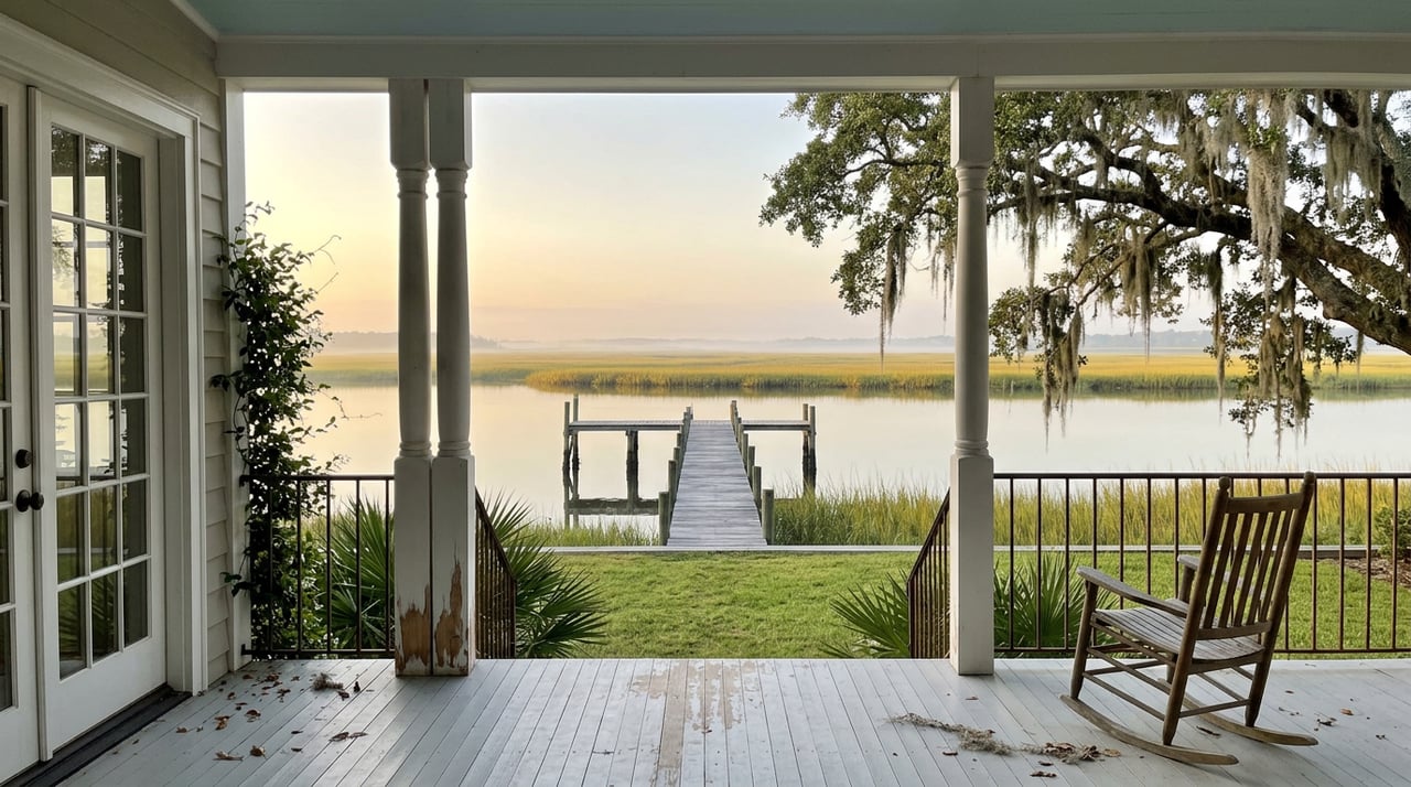
Picture the tour. You walk down from the River Clubhouse, past the pool, toward the floating day dock on a bright afternoon with the Coosaw River wide and full in front of you. The agent mentions deepwater access to St. Helena Sound, a boat basin, a ramp. You start picturing loading the boat on a Saturday morning without checking anything but the weather.
That picture is mostly right. It is also missing one detail that only shows up if you happen to walk down to that same dock six hours later, at low tide, and watch the water pull back from the connecting canal until it is barely covering the mud. "Deepwater" is the word Coosaw Point uses to describe its water access. The tide has a different opinion about parts of the day, and understanding the gap between those two things is the single most useful thing a boat-owning buyer can learn before writing an offer here.
A canal that runs six inches deep at low tide is not deep water. It is a canal with a schedule.
What the Basin Actually Is
Coosaw Point's own amenities materials describe the setup clearly. A 200-linear-foot floating day dock provides tie-up space, with a concrete launching ramp built right alongside it. The basin itself was excavated from high ground and then connected to the Coosaw River by a canal dredged out years ago, roughly 1,000 feet long. From there, boaters have access out St. Helena Sound to the Atlantic and to the Intracoastal Waterway running along the community's edge. The same materials also note a state-maintained launch ramp within a mile of the neighborhood, a detail that matters more than it sounds like it should.
That basin and canal are real, and they do exactly what they are supposed to do most of the day. The word doing the heavy lifting is "most."
The Six-Inch Detail Nobody Puts in the Brochure
Cutting a canal through marsh and high ground to link a private basin to a tidal river is common practice up and down the Lowcountry, and it works well for the majority of a tide cycle. The tradeoff is that the channel was never dredged to a depth that holds up at dead low tide. Residents and other local sources describe the connecting canal running as shallow as six inches at low water, which is enough to strand a boat with any real draft until the tide comes back in. For an owner with a deeper-draft vessel, that can mean a two to three hour wait either to leave the basin or to get back into it, depending on when the trip starts.
None of this is a flaw in how Coosaw Point was built. It is simply how a dredged canal behaves against a Lowcountry tide, and it is the kind of fact that never shows up in a listing photo of the dock at high water.
| Water feature | What's marketed | What it means day to day |
|---|---|---|
| Community boat basin | 200-ft floating day dock with access to St. Helena Sound and the ICW | Fully usable, but only within a tide-dependent window |
| Connecting canal | Roughly 1,000 feet, dredged from the basin to the Coosaw River | Can run close to six inches deep at low tide |
| Backup option | State-maintained ramp within a mile of the community | A practical alternative for deeper-draft boats when the canal isn't cooperating |
Why This Doesn't Cost Coosaw Point Its Appeal
None of this changes what makes the rest of the community work. The River Clubhouse, just under 9,000 square feet by the property owners association's own count, still has its riverfront veranda, a grand salon that rises more than 30 feet with a balcony over the river, and a wood-burning fireplace that makes the space feel more like a family home than an amenity center. The junior Olympic pool and children's pool sit right off the clubhouse. Two lighted tennis courts, pickleball, a dog park, and the Crab Shack, reserved for crab roasts and peel-and-eat shrimp nights, round out a genuinely social calendar of amenities. Almost 130 of the community's 400 acres remain open space, including man-made duck ponds left from the property's days as a private hunting preserve and a freshwater wetland set aside as a bird sanctuary and rookery.
The HOA itself is debt-free, with annual dues running around $1,950, and new construction runs through a Builders' Guild of approved local builders, including Gallant Builders, Allen Patterson Residential, and Chandler Trask Construction. That combination, an established amenity package paired with financial stability and a vetted builder list, is a large part of why Coosaw Point has held its reputation as one of the more polished waterfront addresses on Lady's Island.
The tide detail matters to a specific kind of buyer. If you are drawn to Coosaw Point for the clubhouse, the pool, the porches, and the walkability, the canal's low-tide behavior will barely register in your daily life. If the reason you are looking at a waterfront community in the first place is that you own a boat and want to use it on your own schedule, it deserves a real conversation before you assume the word "deepwater" means what it usually means.
What to Ask Before You Assume Anything About the Water
A few questions are worth working through with whoever you tour the community with, ideally before you get attached to a specific homesite near the basin.
- What is the actual draft of the boat you plan to keep here, loaded and ready to go, not just on paper
- Have you watched the canal at both high tide and low tide, not only whichever one happened to be in when you toured
- Would the state-maintained ramp a mile away work as a regular routine, or only as an occasional backup
- Are you thinking of the water as daily transportation or as weekend and evening recreation, since the tide matters far more to the first than the second
- Does the homesite you're considering sit close enough to the basin that the walk matters, or far enough that it's a five-minute golf cart ride either way
Answering these honestly does more to set expectations than any amount of touring the dock on a good day.
A Few Questions Worth Asking
Does the tide affect the pool, the clubhouse, or the tennis courts? No. The tidal limitation is specific to the boat basin and its connecting canal. Everything else on the property runs on its own schedule.
Is this unique to Coosaw Point? Not entirely. Dredged canals connecting private basins to tidal rivers behave this way throughout the Lowcountry, since the tide range along the Beaufort River and St. Helena Sound is significant. What makes it worth naming here is that Coosaw Point markets the feature specifically as deepwater access, so it deserves the specific clarification.
Does this change how a home near the water should be priced or valued? That's not something to guess at from a blog post, and any owner considering a sale should talk through comparable homesites and recent activity with someone who tracks this market closely. What's clear from talking to residents is that most treat it as a fact of life to plan around rather than a reason to look elsewhere.
Coosaw Point remains one of the more thoughtfully built waterfront communities in the Beaufort area, and the tide chart doesn't change that. It just means the difference between loving your time on the water there and being frustrated by it often comes down to whether someone told you about the canal before you signed, not after.
If you're weighing Coosaw Point against other Lady's Island or Beaufort waterfront neighborhoods, and you want a straight answer about what the water actually does at different points in the day, Lloyd Williams can walk the dock with you at both tides before you decide. Let's Connect.